Pocket Rocket Tigers debut at Wildfire 6hr
This blog was originally published 1 August 2019
Brought to you by Pocket Rocket #2 Nicole Walker
I had such a ball bashing through the bush, hooning round MTB tracks and just general gas bagging with my new found adventure buddie Sara Barrett at GeoQuest in June that I didn’t hesitate to sign up when she asked if I wanted to join her racing at the 6hr Wildfire Raid at Mt Joyce and Wyaralong Dam last weekend.

Introducing the Pocket Rocket Tigers
This 6hr Rogaine had three legs – kayaking, mountain biking and running. For those readers unfamiliar with Rogaining… Definition from Google: a competitive event in which participants find their way with a map and compass. My definition: turn up to an event and having no idea where you are going, how long you’ll be doing each distance for or the terrain, only that you’ll be doing “it” for about 6hrs!
One hour before race start you are given a map with some circles on it and then 59 mins to go, have to figure out how to find them in the bush. Isn’t that like orienteering you say? Well the key difference that I understand between a rogaine and orienteering is that a rogaine you can collect checkpoints in any order, and orienteering you have to collect in the order the race directors set. Or to those that ask, why can’t you just use Google Maps? The IDEA is that part of the challenge of racing a rogaine is the tactical navigational component rather than just pure speed around a pre marked course.
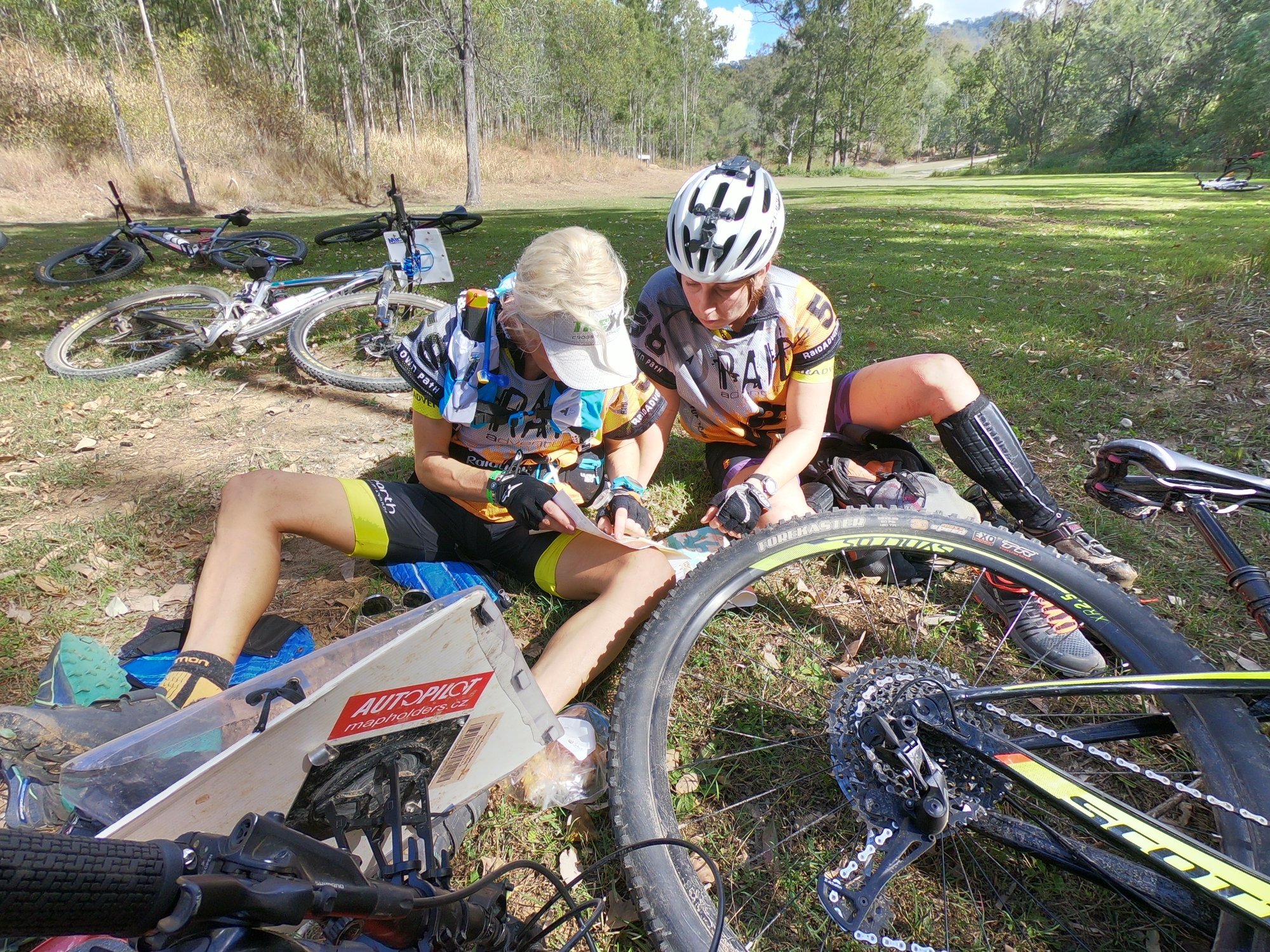
Note to those who want to try rogaining… Things to pack: Fold out table, fold out chairs, highlighters in a few different bold colours (yellow is crap FYI), standard writing pen, black marker pen, ruler, scissors, clear contact. Oh and of course a compass! Be prepared food, drink and gear wise for what you expect (we expected kayaking on a lake, mountain biking on mostly trails and running through scrubby scratchy bush off trail for a total of 6 hrs). Once you get your map the time is ticking to figure out what you need to do and how to do it in the most savvy way to collect the most points. Each circle is a checkpoint and each checkpoint is assigned a number. The number refers to the amount of points you’ll get for “punching in” at that checkpoint. Eg: checkpoint 91 was worth a damn sight more points then checkpoint 14…. and they are rounded down to the nearest 10 - worth 90 and 10 points respectively. The big checkpoints are generally because they are harder and will take longer to reach. In this case checkpoint 91 was a top of Mt Joyce…400m higher than the Hash House (HH) or aka race HQ.

Checkpoint 91 Mt Joyce 469m above sea level, 406m above race HQ
So what I learned is there are a few things consider when planning a route: 1. Big points are good targets provided they are not going to be too time consuming to collect and to determine this we need to take into account distance – ruler handy here, elevation – looking at contour lines and terrain (this one is still yet to be revealed until you get out there!). 2. Look at what route makes sense to get lots of checkpoints eg: if there are a few in quick succession they may add up to more than the 90 pointer and be quicker to get! 3. Paddle points don’t have elevation so may be more predictable timing. 4. Whatever plan you make, also plan to change the plan…. several times! There’s probably many more tips and perhaps I got these ones wrong but I’ll be keeping these learnings in mind for next time!
We mapped out our route with highlighters, stuck the clues for each checkpoint somewhere handy to look at and decided what food/equipment/fluid we’ll need where, had a last minute toilet stop then lined up all within the precious 59 minutes.
We had a ball! Starting out on the trek choosing an ambitious, albeit beautiful route around the headlands of the lake, practising counting corners, walking up Spurs for stunning Wyaralong Dam views and getting thrashed by speargrass and thick Lantana. For those kiwi readers and Aussies who don’t go bush often I intended on finding a photo of this awful stuff but I couldn’t find anything that did it justice so stay tuned for my next blog during which I’m sure I’ll have another exfoliating session I can take a picture of. Try to imagine walking through a crowd of people where everyone has their fingernails out ready to scratch you as best they can and then the odd child has a stick in hand which they decide to prod you with unexpectedly wherever they like and that’s about Lantana! Why would you walk through that? Well to find a checkpoint off the track we need to follow “handrails” (thanks Rob Preston’s nav lessons!) which are features in the terrain that help you know you’re on track. Such as a fence line, ridge, spur or finding a “flat spot” in the hill. Now if you decide to avoid the scratch fest it’s very easy to lose these landmarks and therefore lose your position on the map, the checkpoint and waste time “beating round the bush”. So basically you can’t go under, over or around it you just have to go through it!
We took an anti clockwise route and decided that no matter the cost we wanted to get up Mt Joyce and would not miss out on the “scenic” route. It was a steep old track but pretty easy to follow so gave the brains a bit of a breather. The views gave us a boost (as well as the bananas consumed at the top) for a steep technical jog down to find CP 22. This one was a little sneaky out and back for us but we found with no dramas and no unnecessary elevation loss or gain. At this point in the race we’d had a feel for what the MTB would be like running on some of the trails and decided to flag most of these checkpoints. Steep fire trails, technical downhills sure looked fun…but time consuming and we were racing after all!

Spectacular views up Mt Joyce on this gorgeous Queensland “winter’s” day
We got a few mountain bike check points on the way into the run course and left our bikes with the friendly TA1 volunteers / go pro photography extraordinaires. It was nice to get back there, have a mid race Sambo (what Aussie’s call sandwiches FYI) and nail a few easy bike checkpoints on the way out. The one actual MTB trail we did get onto gave us a sweet little taster of what fun the park had to offer and Sara and I vowed to get back out there for a bike sesh another day!
I have to say cutting the mountain bike a little short was attractive to me as a paddler at this stage. Having looked out over the completely glassy dam running around in temps of the mid 20’s for a couple hours, getting in that gorgeous water was too good to wait! We got to the paddle leg with 2.5 hrs to go and decided to give it a shot to sweep the paddle course. Hilariously we were so keen to get paddling we forgot to get the easiest bike checkpoint on course a little 14 pointer basically in the carpark… whoops!

Wyaralong Dam flat as a pancake
The paddle was the other highlight for sure. Absolutely flat as a pancake it’s rare to paddle on water like that in the middle of the day, especially being used to NZ winds! We took an anti clockwise route deciding it would be an easier way to drop just one or two checkpoints and still getting the high pointers if we ran short of time. Paddling without any navigational mistakes, at a modest pace for these pocket rockets, enjoying a Sunday yarn it was a rather pleasent way to spend an afternoon actually. Seeing other teams pretty regularly meant for some good banter on course too. We got nearer to the end and realised we would sweep the kayak course and get all the checkpoints meant we had to knuckle down to ensure some safety time to get back to the finish. And of course time for a selfie to wrap up the arvo!

Stoked to sweep the kayak course!
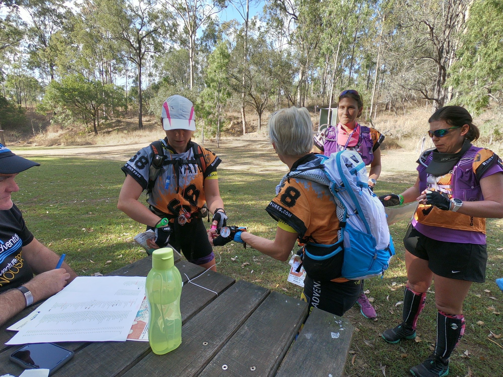
Absolutely not forgetting checkpoint 14 on the way out after getting back our land legs we were off and away to the finish line! Finished in a time of 5 hrs 49 mins and 1060 points on our belts we managed second placed female team and 7th overall! With the calibre of athletes around us Sara and I were pretty stoked with that!

That’s a wrap!
The Wildfire Raid 6hr at Mt Joyce this year was well supported with some awesome volunteers spending their Sunday help make this fun event happen and certainly the organisers did a great job making it fun yet challenging, scenic yet shitty enough to keep us toughened up and for the top teams it seems to have the goal of clearing the course kept in sight without being easily achieved. Liam and Adam seem to be the main men behind the manpower – thank you gents!
After some post race yarns, a cold lemonade and fresh Subway Sambo that was a wrap. Watch out for next edition… Pocket Rockets 2.0. Looking forward to the next A1 series adventure race in our backyard Maroochydore on the Sunny Coast in two weeks time….the 24hr Hell’s Bells!

Post race Lantana scratches made for a few interesting conversations in my work skirt on Monday… Back to work reality after another stunning adventure weekend!