Gravel Bikepacking the Tasmanian Trail

The Tasmanian Trail
Tasmania is beautiful, no doubt about it but Tasmania is also rugged, wildly unkempt and sparsely populated making it the perfect place for two adventurous souls to explore for a challenging yet rewarding holiday. This was my first visit to Tasmania, therefore I am no expert however I would describe the Tasmanian Trail as the heartbeat of the true Tasmania, wild, challenging, remote and yet stunningly, ruggedly beautiful.
What is the Tasmanian Trail?
The Tassie trail runs between Devonport on the North coast to Dover on the South coast of Tasmanian interconnecting 500km of mostly (85%) gravel or off road trails. It is a multi-use trail for hikers, horse riders and moutain bikers kept (remarkably well) by the Tasmanian Trail association. There are many free campsites and basic facilites along the way and it passes through enough small towns to avoid needing to camp or carry multi-day supplies should you choose this style of adventure. The traditional route runs from south to north and it is recommended to take 7-10 days on mountain bikes. However we are all for unconventional adventures and decided to ride from north to south… in 4 days… on gravel bikes.

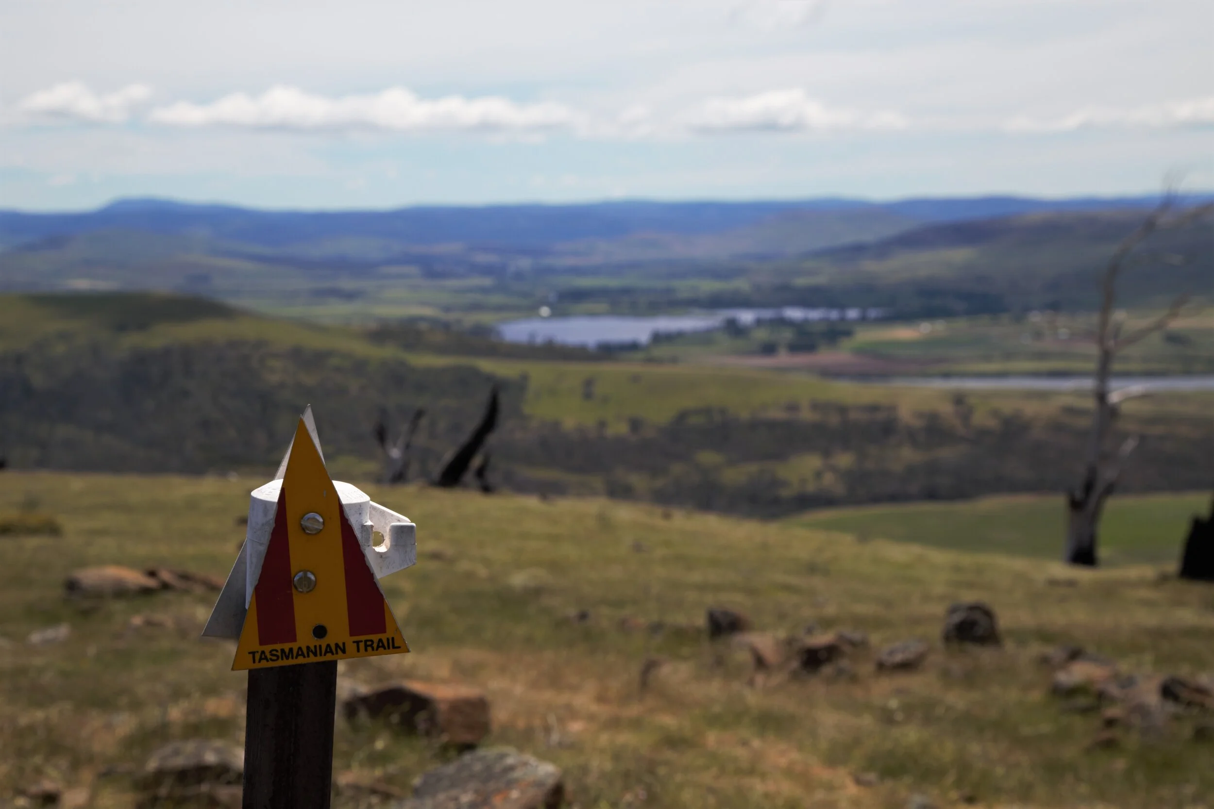
Tasmanian Trail markers subtley and sometimes scarcely dotted along the trail to guide your adventure
Planning your ride
In terms of finding info about the trail there is a whole Tasmanian Trail website (free and super helpful) and Tasmanian Trail guidebook ($40 membership + $30 for the book and GPX file for your device). There are a few cool blogs out there including the one we found the most useful for our North - South adventure by “Where’s Thor”, also a friend of mine with similar fitness so we based our plans mostly off this. The trail is marked the whole way with red/yellow striped triangles as shown above. However I would not like to rely on these, as we noticed some trees down with markers (therefore not pointed in the right direction), some were a little overgrown and hard to find, some were confusing as to which direction to take and others were non-existant at intersections. Although it was obvious the amazing Tasmanian Trail association had done a great job with upkeep - it is near impossible to get it perfect with the length, remoteness and weather of Tassie. I would encourage everyone to have another form of map - preferably a well chosen Garmin file showing you the way with Trail markers to confirm!
Day 0: Riding to the trail - Launceston to Sheffield

Day 0: Lanceston to Sheffield via Railton
Distance: 101km Elevation: 943m Moving Time: 4hr 49min Total Time: 6hrs
We flew to Hobart at the start of our Tassie trail adventure, did a cool hire car road trip up the East Coast and dropped the rental off in Launceston. It was inconvenient for us to get to Devonport for the absolute beginning of the trail, so we continued to be unconventional and decided to ride from Launceston to meet the trail in Railton (the “almost” start). It was a rather dull first day but great to warm up the legs and get used to the loaded bikes. We managed to find some pretty quiet roads and only were on the main highway for a total of 2km to prevent a 16km detour.
Along the way we discovered we were following the Cradle to Coast Tasting Trail when we stumbled across the Dixie Blue Gelato Cafe in Deloraine which had an impressive Gelato selection! Being mid morning we made the sensible mistake of having our homemade wraps for lunch and a coffee first, sadly then being too full for their amazing looking Gelato! Picking up our Cradle to Coast Tasting Trail map we vowed to try out some of the other tasty looking delights along our path. We had been recommended The Elizabeth Town Bakery by our Lanceston taxi driver the day before which was only just up the road. However we also didn’t stop - tragedy for all the foodies reading this… I know, but it was a really good lunch wrap ok!
Onwards for the afternoon, we intended to ride to our destination for the evening Sheffield, but with some time up our sleeve in the day we decided to tack on an extra 10km and a few hills to head up further to Railton for a beer at the Seven Sheds Brewery just about the only attraction in the town. The sun was shining, the weather pleasent as we rolled in to this cute little old railway town at 4pm just in time for a cold beverage. Only to be a touch heartbroken when we realised it was closed Mondays and Tuesdays! This first day we learnt an important lesson about the trail - expect everywhere to be closed, unless you have looked up the opening hours and in many cases ALSO called to confirm! Since COVID, many places did not have updated opening hours on Google. Given the towns we passed through were very small they didn’t have early nor late hours either. Therefore without planning ahead we might have been in trouble rolling in late without checking where would be open. So instead we took a moment to try and enjoy the other “attraction” in Railton, known as “The town of Topiary” which I guessed was something along the lines of hedge trimming. So we posed with a hedge, had a banana next to the hedge and utlised the clean and tidy public toilets next to the hedge before sighing and carrying on out of the town to find the trail.
The trail entrance is located on Railton Road just slightly south of the main Foster St/Railton intersection and the gate to head south is on the western side of the road.

Starting the trail in Railton, excited to get onto the dirt path.
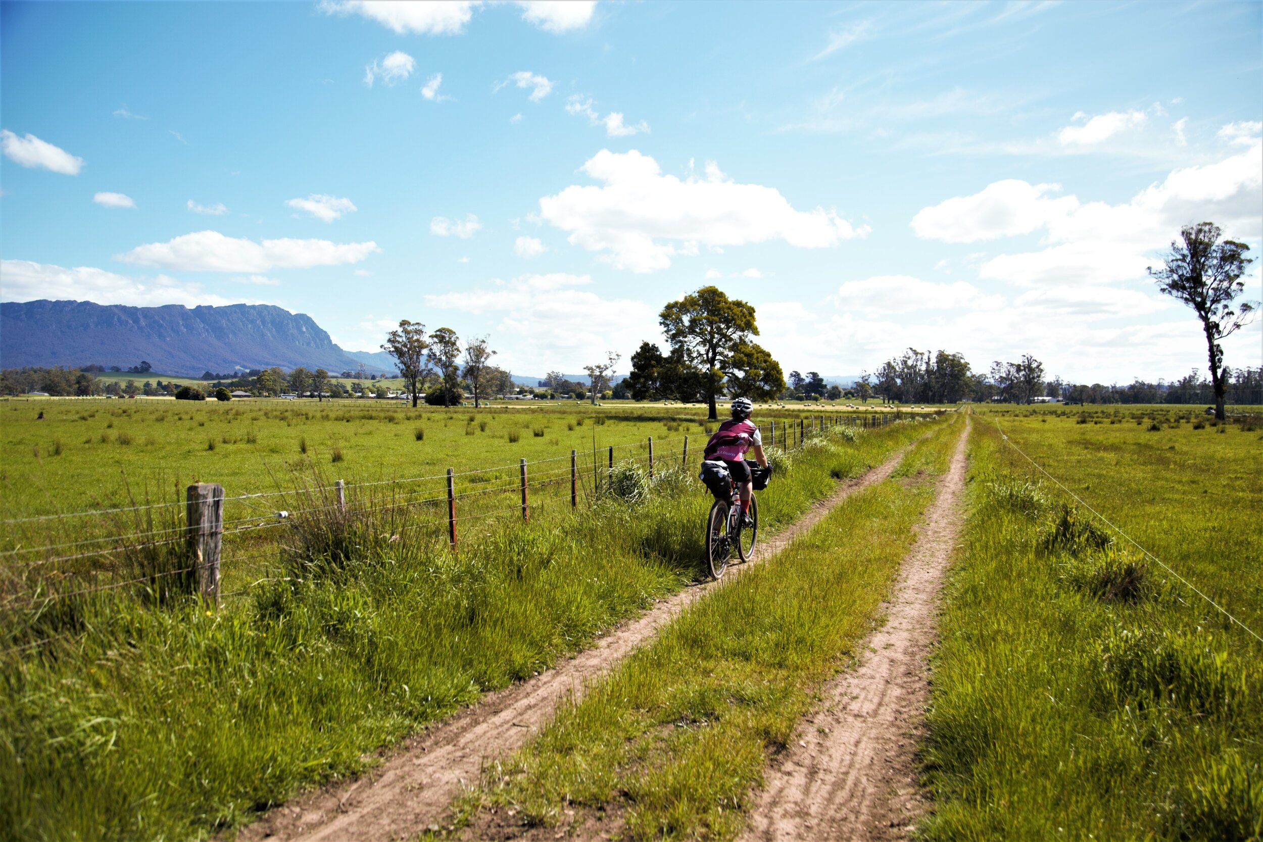
Bumping along the track, getting used to my first gravel experience on the new bike and a fully loaded gravel bike we took it slow for the 10 ish km to Sheffield. Getting used to the arrows and enjoying the peacefulnes of the forest, we certainly were getting excited for the journey to come. After a couple of (small) hills we broke out of the forest into a field doused beautifully in late afternoon sunshine.

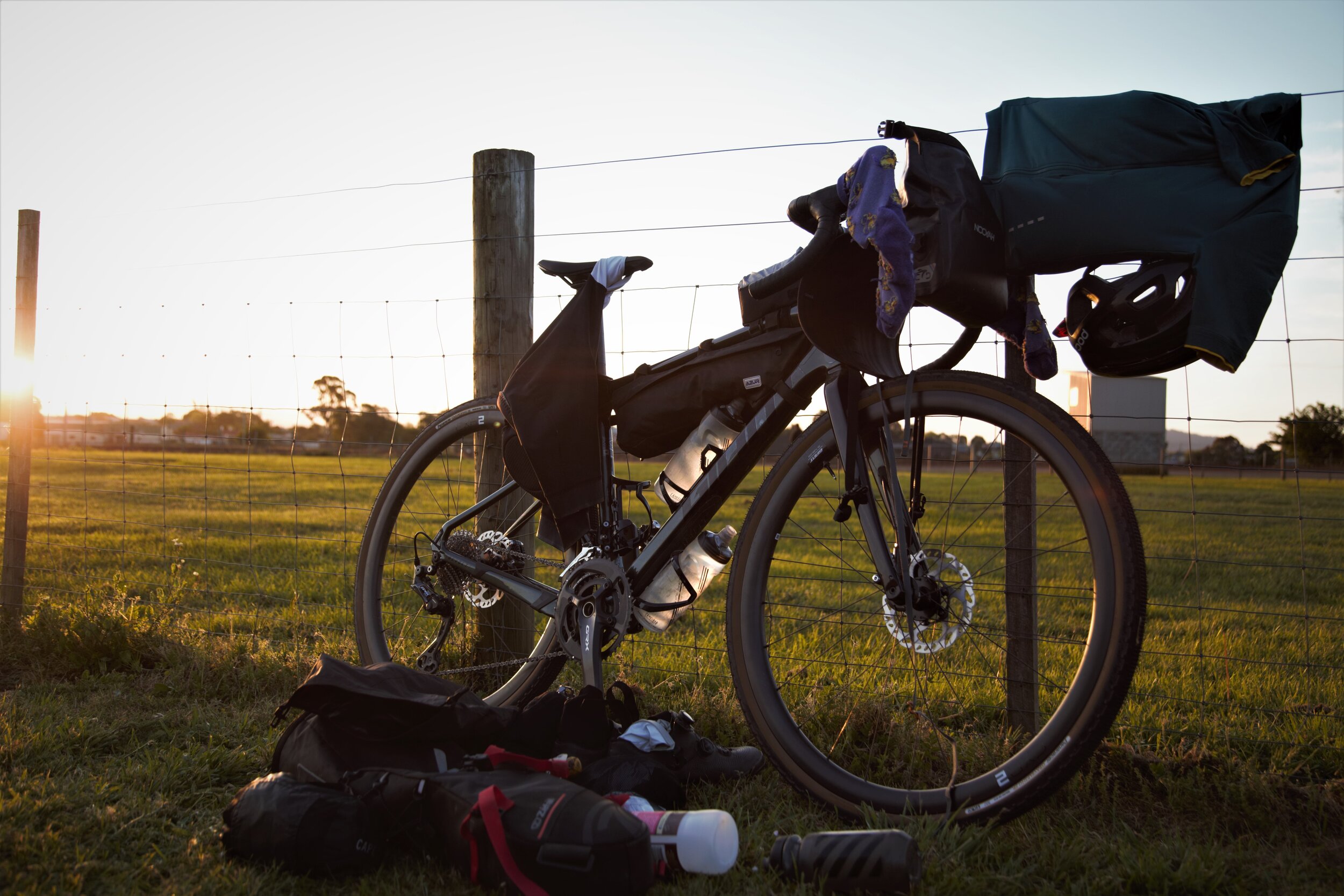
One of the few gates that were open without a trail key
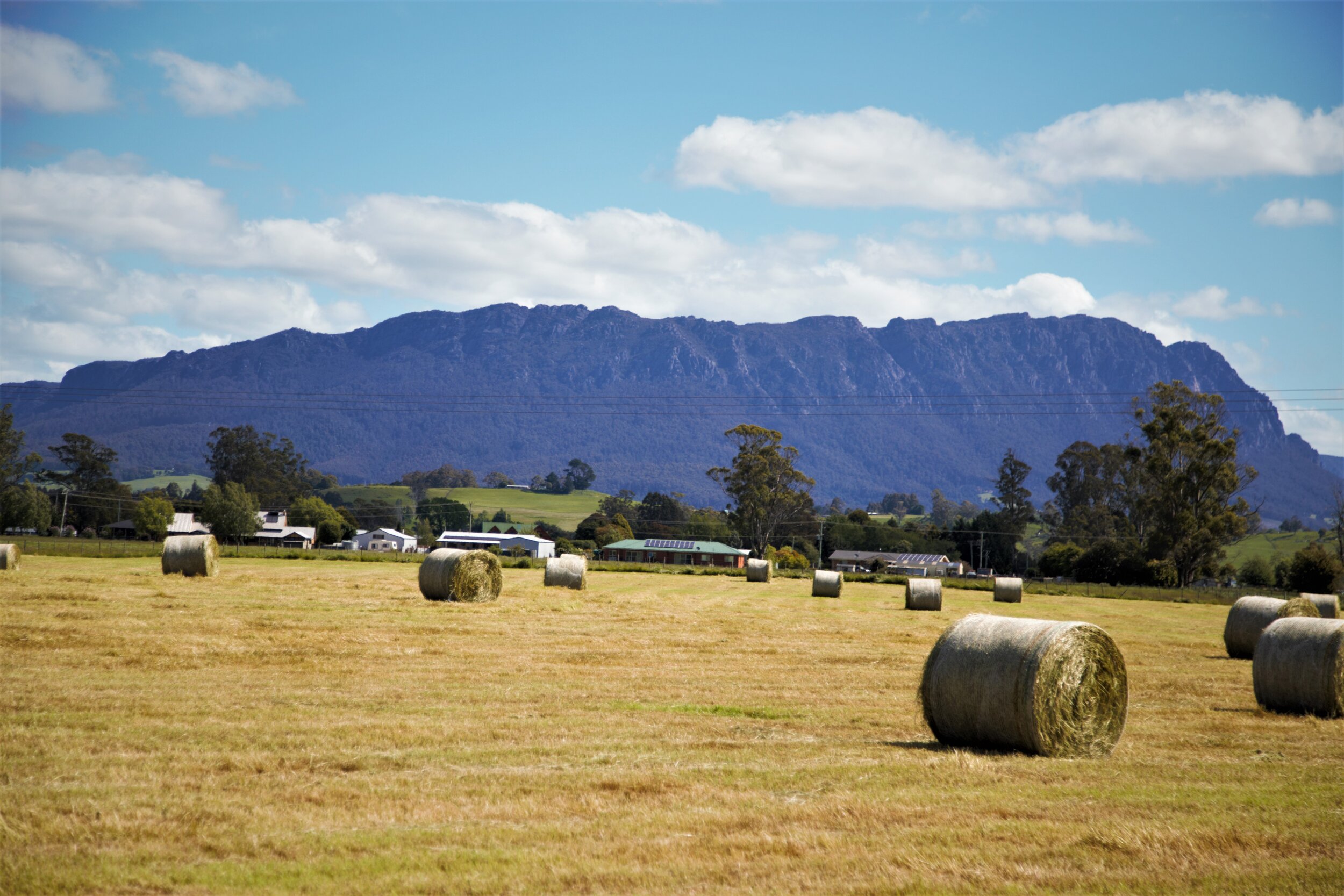
We rode in to check out the town of Sheffield, actually rather stunning in the wake of Mt Roland. I have a recommended habit with serious bikepacking (as in long days, hard riding). Always find your recovery food before going back to camp or your accomodation - you’ll thank yourself a million times over later! It is all too easy to want to get to your accomodation or set up camp and unload the bike however it’s always at least a couple hours until you actually find food, if you manage to get out again at all and shops close in small places too! By that time you are ravenous, not thinking straight and all seized up. Especially if the weather is bad or it’s cold outside. Of course we are bikepacking here, it’s not a race so of course be as laxy daisy as you like! But to feel good for 4 days, 500km and thousands of metres elevation…it will help! So choccy milks, iced coffees and sandwiches later from "The Don Store” we were ready to go and find our camp for the night.

Parked up in the Park Sheffield

Riding to find recovery food in Sheffield with Mt Roland stealing the show in the photo
“Always find your recovery food before going back to camp or your accomodation - you’ll thank yourself a million times over later!”
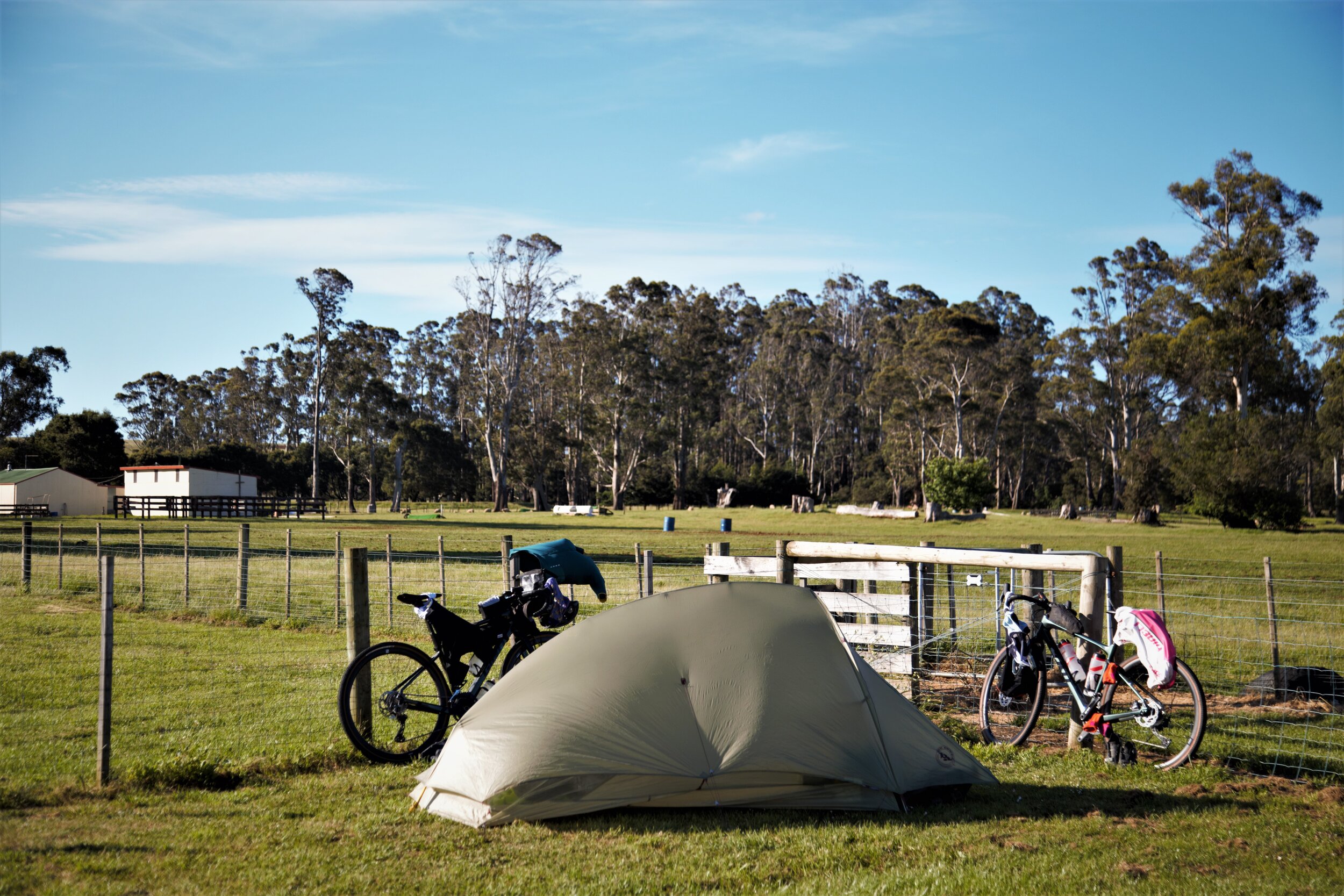
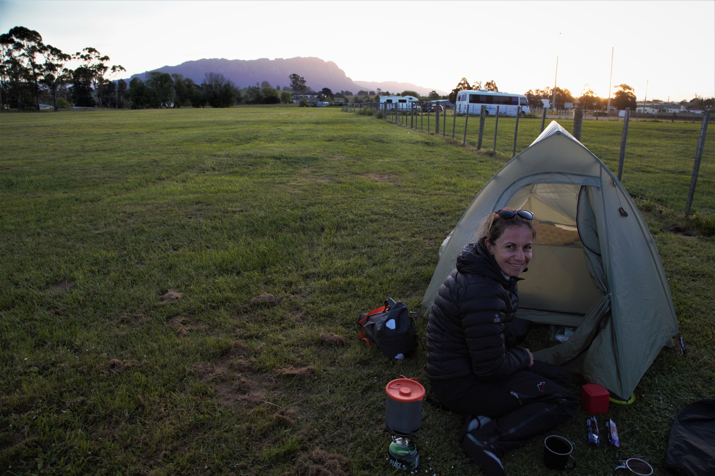
Free Tasmanian Trail users camping is located in the Sheffield Football and Cricket Club on Spring Street. There are signs where the RV free camping is located that explicitly say tents not allowed, users must be self contained. However behind the dog park and in the next field over from the RV’s there is a little Tasmanian trail marker on the fence where the field meets with E Victoria Street. Toilets are accessible if you order a Tasmanian trail key (we just used the ones in town before and after we camped leaving no waste). Setting up our home, having a little lie down, airing out sweaty cycling gear and cooking up our freeze dried meals we settled in for a chilly night in Central Tassie.


Day 1: Sheffield to Poatina

Day 1. Sheffield to Poatina
Distance: 122km Elevation: 2060m Moving Time: 6hr 45min Total Time: 8hrs
It was a slow start leaving the campsite around 8.30am, once the tent had dried a little of dew and we made the mistake of deciding to go to the Mountain Mamma cafe for a delicious breakfast. Don’t get me wrong it was a delicious brekkie spot, highly recommend except for us it was slow. Because we were slow to pack up camp and didn’t have brekkie on the go we didn’t end up riding out of town until 10am! Whoops. Only to set off for what we didn’t realise would be an 8hr day…!

Riding to the Gog
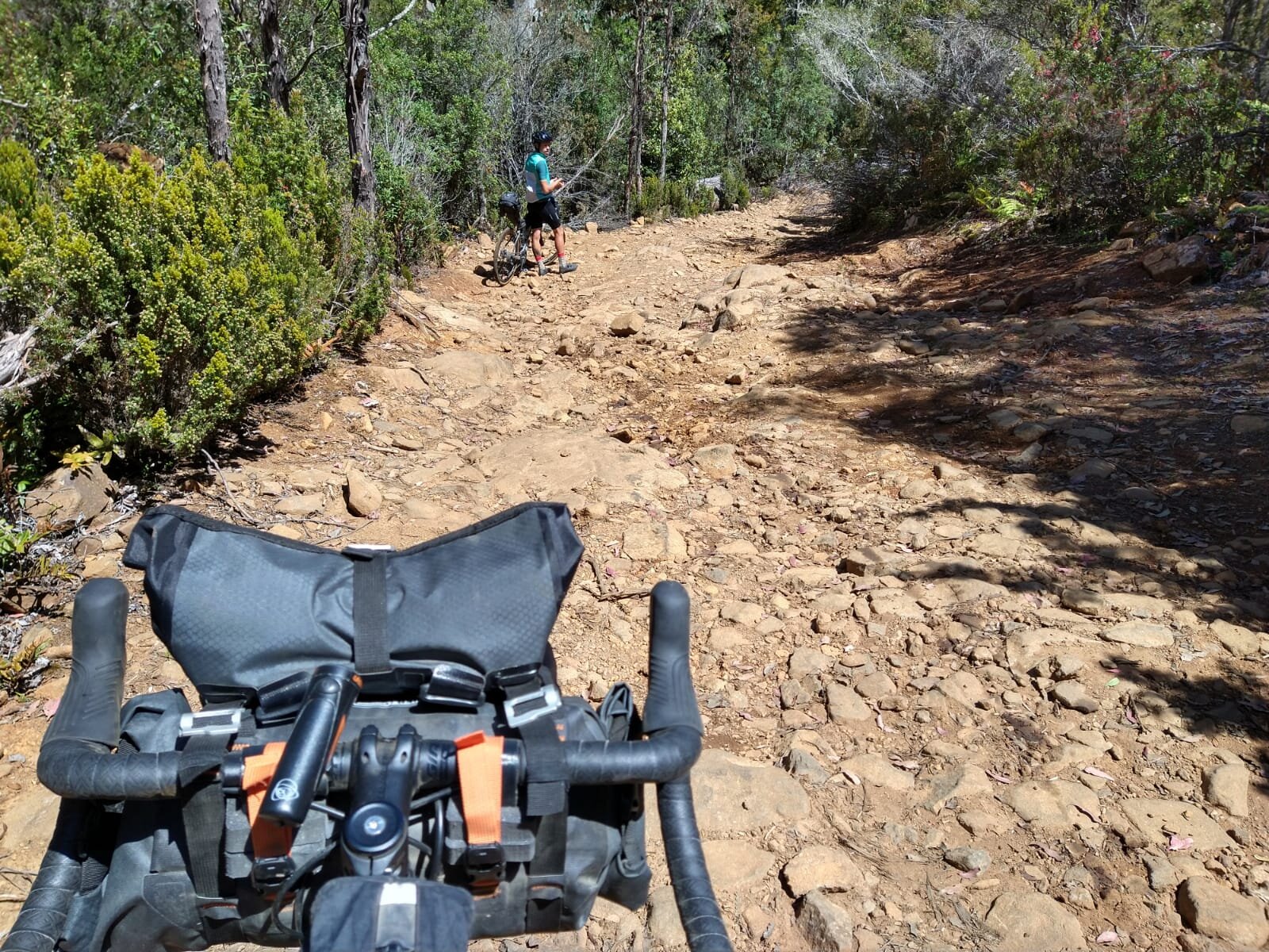
Riding out of town we found the trail on Formby Street, which started with a nice little downhill, giving us a view of the hills to come. Today’s ride didn’t pass through any towns so we were ladened with riding food for our journey. The first section of the ride took us through the Gog Range which started with pretty nice fire road through a logging site, a decent little climb before our first taste of the amazing Tasmanian trail descents. Still getting used to the bags I took it a little cautious at the start but my Giant Revolt Advanced 0 was made for it and Ortlieb bags hung on amazingly well. So it wasn’t long before I was letting rip and flying behind Cameron through the tall green trees, down the smooth fire road and dodging the odd threatening pot hole. I learnt at this point that it is smoother to descend and not use the brakes, especially on the lumpy bits of the road - if I was game enough!


Riding the Gog Range
The smooth wide road started to turn a bit lumpier and overgrown as we got closer to the Gog Range Camp alongside the Mersey River. At the Gog Range Camp, we had a snack break (for us 5-10mins, a muesli bar and a toilet stop) and massaged our cramping hands from all the braking down the last little slippery slope. We came across a cute little hut - although in this Aussie bush I would much rather sleep in my tent than share that house with all the spiders and who knows what else!

Gog Range Camp
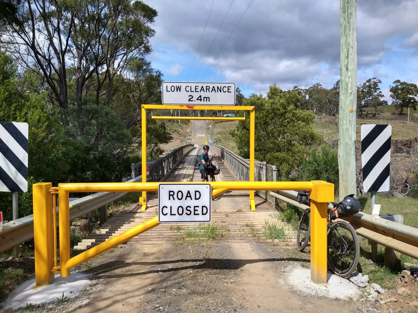
Soon after leaving the hut we had our first river crossing! We had a little debate at this point - to keep shoes on or take shoes off! I felt like I wanted a little more protection from the slippery looking rocks, and generally wouldn’t bother from adventure racing ventures but Cameron was determined to keep his feet dry! I have to swallow my pride and admit - dry feet was a good call and worth the 5mins of taking off and putting back on, considering we had another 6 hours in our shoes. It was a decent crossing and would need to be considered carefully after rain with a fully loaded bike - as the sign suggested on the other side “check river height and cross without gear first”.

Taking the bikes for a swim, yes it did get a little deeper…
I would also recommend always having the bike downstream of you - unlike in this photo - so you can (if needed!) let go without taking yourself out

Looking back on the Mersey River crossing

Keeping the feet nice and dry! Smarty pants
After our river crossing the terrain got much slower, we had to navigate the trail amongst a few fallen trees and the trail wasn’t obvious whilst hike-a-biking the small ridge out the other side. Looking back it was certainly the trail, but it had been pretty smooth sailing until this point making us question if we were on the right track! Finally getting back into rideable territory, we knew all too well had done a mere 30km in 3 hours and knowing we had 120ishk to do that day that was rather daunting! The road climbed once again out of the valley up and up and only got steeper in the midday sun. Once again I was impressed with the gravel bikes and gear range for climbing, enabling us to stay riding and preventing the dreaded hike a bike!


Finding the Trail was sometimes a mission

And the Trail itself was sometimes a mission!

Working the Granny Gear on these hilllsss

Views totally worth it!

Popping out over the top and out of the forest
Out of the forest for a short while we rolled through farmland on a nice descent with views that made it all worthwhile! Crossing a bitumen road very close to Deloraine (the gelato place we stopped for lunch in yesterday!) and rolling down another for all of 5 minutes we shortly got back onto dirt. Getting a bit peckish now we decided not to head into town but carry on to the 41 degrees South salmon farm for a late lunch. Crossing our fingers and toes that it was open in these quiet tourist times due to COVID-19 we were pleased to see it open. I was also super stoked they had simple salmon sandwiches on the menu! Perfect for hungry bikepackers that still had 70k of riding and plenty of hills to go! For those on a more leisurely day their platters also looked amazing!

41 degrees salmon did not disappoint!
Lovely spot, time to move on - we still had a load of riding to fit in before … well night I guess. But prepared with lights I guess it really wasn’t a problem how long we rode for! Heading out we had a relatively easy run for the next 20k - here we missed a turn not quite knowing what the “alternative route” had in store and we instead followed the road around through Golden Valley to Quamby Brook. Then we had our final and very noteworthy 500m of elevation hill for the day! Rather nice terrain, steep yes but rideable and chatting away the good hour of climbing time passed enjoyably for a hill section! Amongst tall forests and on amazing gravel, the afternoon was what this adventure was all about!

Tassie Gravel at it’s best - finally riding along the top!
The downhill was epic! For me also a skills test on some messy 4WD tracks, getting steeper and steeper as we descended! A true adventure for the gravel bikes on Day 1! Getting right back in the saddle (as far as the saddle bags would allow) and braking hard (but not braking because then you skid) and navigating the slope for rocks and fallen branches made for a fun time!
Finally breaking out into the clear again and onto Bracknell Road we had a decision to make - call it quits for the night (5pm ish already!) and head into Bracknell. Or ride on for a final 30km to Poatina and sticking to the orginial plan. We decided on the latter to get it done. Not before calling ahead to the Poatina Chalet asking if there might be anywhere open for food when we arrive at 6-7pm! The guy had good and bad news. No - everywhere closed at 4pm. Yikes. But he said the Chalet would be more than happy to make us a ham roll for dinner - STOKED and check us in late.

Decisions Decisions - tomorrow’s hill in the background
Thankfully a tail wind and flat roads made it super fast going and a good choice to get those k’s under our belt! We stuck to the road as the trail was quite indirect here given we decided not to go up the hike a bike the next day and instead the Poatina road climb. We hooned for an hour on the flat, until I realised Poatina is yes indeed a cute looking little town. But it is a cute looking little town perched on the top of a decent little hill (probably explains the views!) and by that stage - I was struggling!
We finally rolled into the little town - not seeing a single soul. The Poatina Chalet chef was one of those people you feel like you have always known and told us we not only had ham rolls waiting but a full Ploughman’s platter AND the campsite was freshly mowed just for us (how special can a girl feel in one day?)!
So the Chalet has proper fully catered motel rooms, hostel type accomodation and a patch of grass out the back they let campers use too for all of about $10 a night. Laundry facilities and hot showers were a treat too. If we got their early enough we could have paid for a full restaurant meal. Lucky for us we could still join the continental breakfast in the morning before an early start too. Did I mention the resturant had the most incredible mountain views? This all makes the Poatina Chalet a great spot for Tassie Trail goers - if you choose to pass through it!

Pretty sweet view for $10! Note - freshly mowed! Soft for sleeping too!
Well only day 1 of the trail proper and we were feeling buggered, elated and content with adventure. The only downside to day 1? I lost a jandel. On one of the bumpy rough descents - a single jandel bumped it’s way out of my straps on the saddle bag. Alas I was down to hobbling on one - much to Cameron’s embarrassment in hanging out with me. One is always better than none!

One is better than none right?
Day 2: Poatina to Ouse

Day 2: Poatina to Ouse
Distance: 144km Elevation: 2101m Moving Time: 7hr 54min Total Time: 10.5hrs
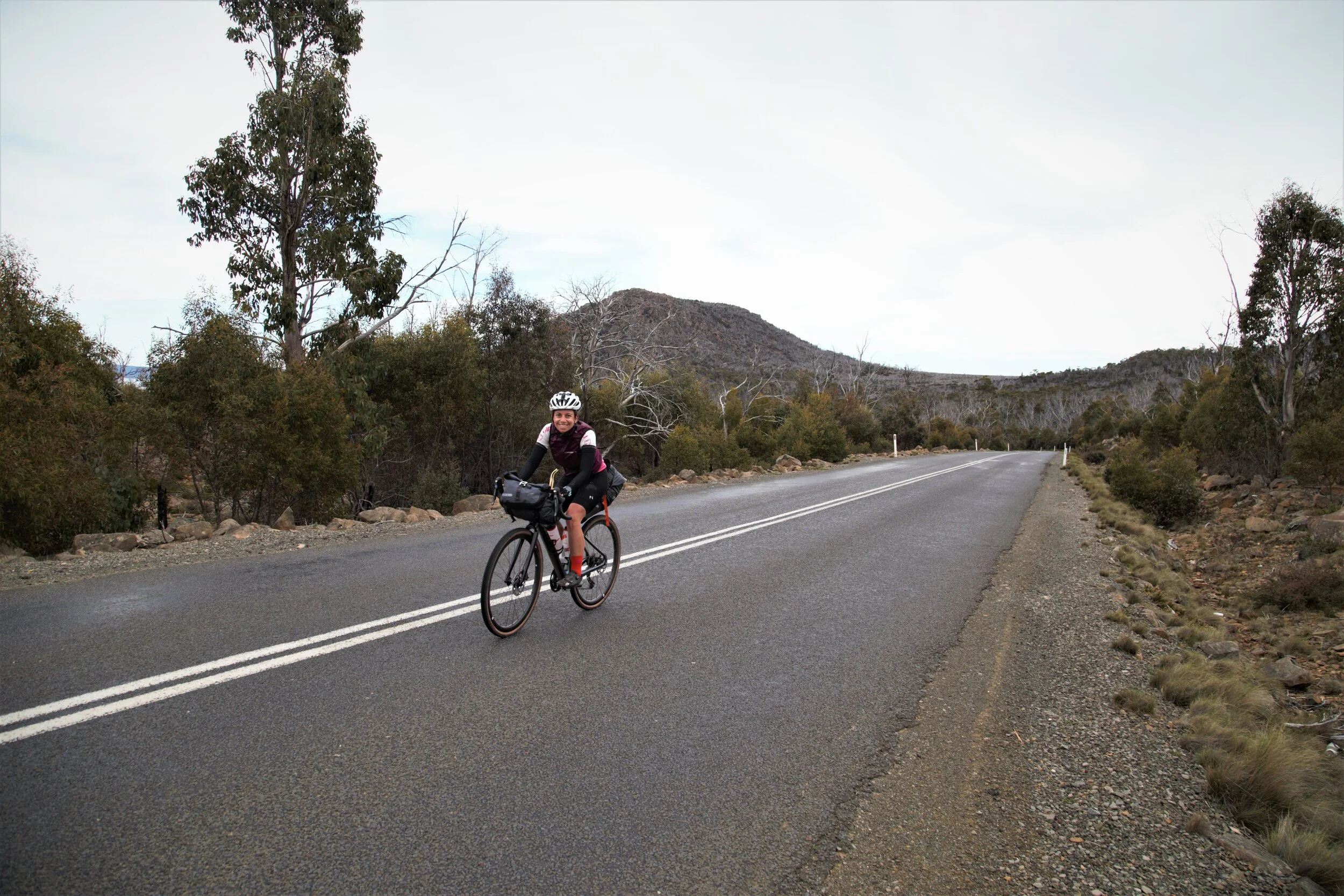
This time we got our butts out of bed earlier and managed to get the tent etc all packed up for our continental brekkie at 7ish. Saying goodbye to our lovely hosts we rolled out of town feeling creaky and sore but also excitedly nervous for the day ahead. We knew it would be our biggest day yet and had heard rumours of the mighty Poatina Rd climb which apparently features on many of the road cycling tour races in Tassie. Poatina climb snaked up the hill without too much traffic as feared, but unfortunately without many views either, from 300m to 1100m elevation over 10km. We were passed by an old dude in his 60’s riding 200km that day for fun - keeping us grounded that we weren’t considered that hardcore afterall in Tasmania! It was actually a nice gradient with smooth roads and some cool switchbacks - I love that sort of thing so I’d recommend it for any cyclists visiting Tassie. Or people who like to drive that sort of thing too!
Getting to the top - we were definitely in elevation now. Feeling familiar to me like the central plateau of the North Island, NZ. Tall trees and dirt turned to scrub and rocks as we snaked around the lakes in the Great Lake Conservation Area riding at between 1100 - 1200m and thanking our lucky stars the weather gods were on our side! It was super exposed and would be a nightmare to ride for these two resident Queenslanders if the weather was even slightly unfavourable.
Riding along the top! Central Lakes
The Trail markers directed us down to ride on some “big gravel” trails alongside Arthur’s lake - a seemingly popular camping and fishing spot I’d imagine in summertime. By “big gravel” I mean small rocks. On smaller tyres like we had this means your tyres slip between many small rocks as you ride making it quite a workout and quite the balancing act at times!

Riding down to Arthurs lake

Enjoying Arthurs Lake

Arthurs lake

Big Gravel
After mucking around with a few pics and having a snack stop the trail sharply headed back up towards the road. We basically just crossed and then it turned back onto a fire road again. Well up what looked like a wall of steepness in front of us! After a quick delayer and mental pep talk at the bottom we got into it. I was pretty happy to make it up this one without walking - but it was very close! I find that these sort of challenges you just have to tackle all by yourself. It is mostly mental. Yes physically I was busting my ass for several minutes - possibly half an hour but my key to keep me going is to have a mix of both intense concentration, talking bullshit to myself and an element of distraction. In my mind I think of every breath being refreshing for my legs, I count down, I just think of the next corner, I never tell myself I am near the top until I ACTUALLY am and I drift into a song that matches the beat of my legs. I let my mind wander to a topic I can ponder on for hours or I am concentrating on the technical aspects of the ride - avoiding the big rocks, loose dirt, soft sections and ensuring my pedals are turning as steady as possible to prevent them slipping. Red-lining for sure but always just keeping a tad below blowing up and therefore having the ability to just. keep. going. I have no idea if there is proper strategy behind that but it works for me and I am pretty good at just keeping on going.

This photo doesn’t do the hill justice alright!
Popping out at the top we rode alongside a cool canal! Flat but ever so slightly downhill along the top made for an awesome few kms. Topping it off with a few echidna spottings - life was good! Descending down to the road - we were destined for 10km or so of road with a massive headwind to Miena. Thankfully my company is a bit of a machine that I am allowed to hide behind sometimes - just ensuring I throw the occasional “you are doing great dear!” forward in appreciation, and shout the iced coffee at the end.

Canal cruising

Cute little Echidna fella - they seem to think they are invicible and hidden as long as they tuck their head in

Riding fuel - can you tell we were just a little bit hungry shopping?
After fuelling up at the Great Lake General Store (full of hot, cold and pre-made goodies) at about 1pm we knew still had 85km to go to Ouse. Once again we checked where the campsite was before Ouse in case we had to stop shy of our goal for the day but decided to push on if we could, and it was downhill after all! Rolling out of Miena we immediately started an awesome decent on some cool gravel. Although the fun was thwart with massive trucks travelling at speed around blind corners leaving a trail of dust and the odd steep pinchy hill to keep us from enjoying it too much. But the descent continued and continued and continued - it was actually amazing! Starting through the plataeu with the tussocks and rocks and wide open landscapes, moving into the trees again whilst warming up in temperature at a pretty steady rate. Then all of a sudden we burst out on to a road cut into the side of a hill with a steep drop down one side into views of the most amazing valley with a ribbon of water running many feet down. We took about a kilometre to stop - going 50kmph on steep gravel roads it takes a while! And a moment to take it all in with a few pics.

Popping out just above Bronte Park
Still a fair way down!

Rolling on
27km later after lunch and 500m elevation loss we rolled into the Bronte Park General Store with it’s hilarious signage - looking vastly different from the landscapes of Miena. Here we massaged our once again cramping hands from the brakes (common theme!) Refilled water and grabbed another snack. We made the mistake of filling up from a random tap at the service station in Miena. DO NOT DO THIS! It tasted like I had just had a drink of the water that comes directly out of a boat motor. I am still alive a month later at writing this so it wasn’t deadly, just disgusting, but it can’t have been good!
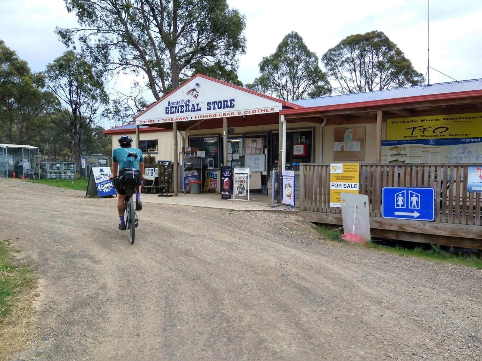
Bronte Park General Store - another handy supplies stop

Eye catching Coronavirus signage
Rolling out of Bronte Park we soon turned off the Lyell Hwy heading towards more smaller ups and down hills. It was quite a pleasent ride alongside Dee Lagoon that had a cute little island in the middle reminding me of a Slovenia-type scene. I was rather enjoying myself tootling along, while Cameron was patiently reminding me we still had a long way to go! Heading into the dense forest for a while we then started to descend again. Starting on some wider, more open trails it then turned rougher and steeper and once again the nerves and the bikes were tested! Flying down this fire trail I thought to myself there is no place in the world I would rather be than right there in that moment. Next minute a 4WD comes flying around the corner just missing Cameron in front of me and I had to roll over some pretty sketchy bit of track to steer clear! Sharp turns certainly aren’t an easy manouvre on the gravel and we thanked our lucky stars when we got to the bottom safe and sound! And once again - nursed cramping hands for a couple seconds!

Rolling along Dee Lagoon - those ducks look keen for a swim


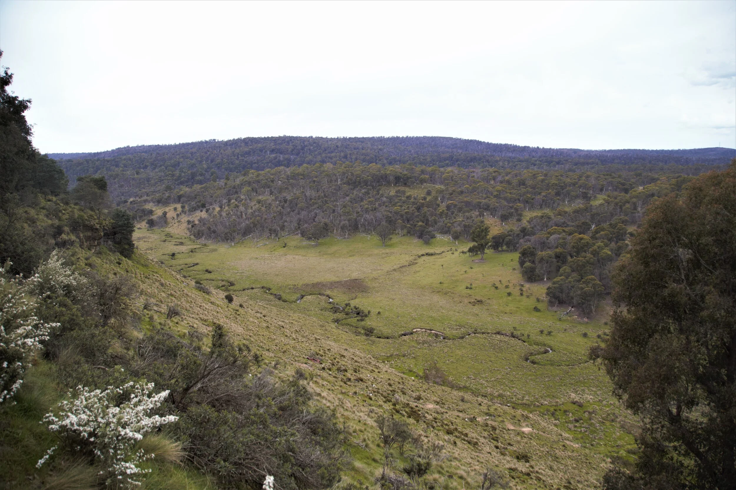
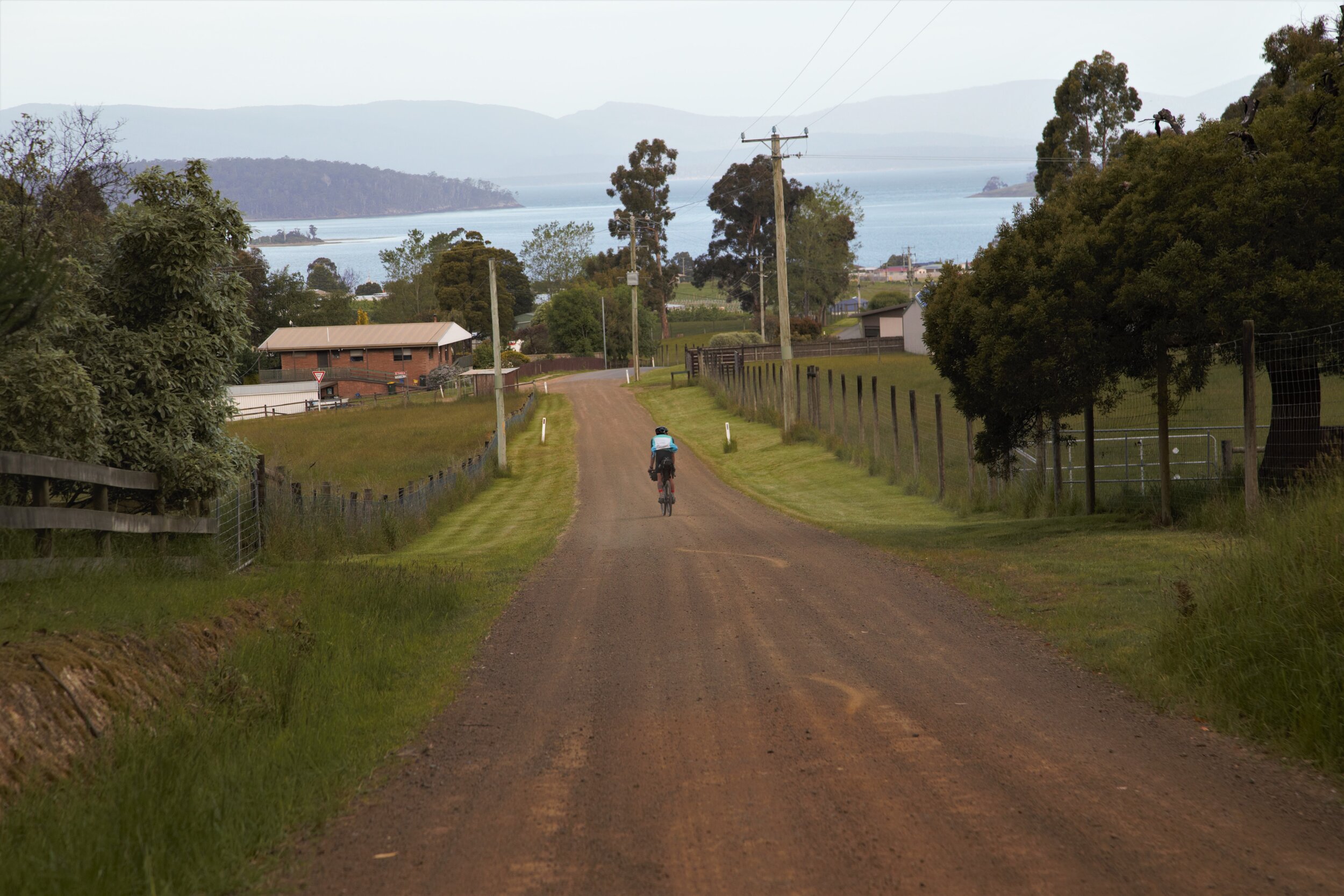
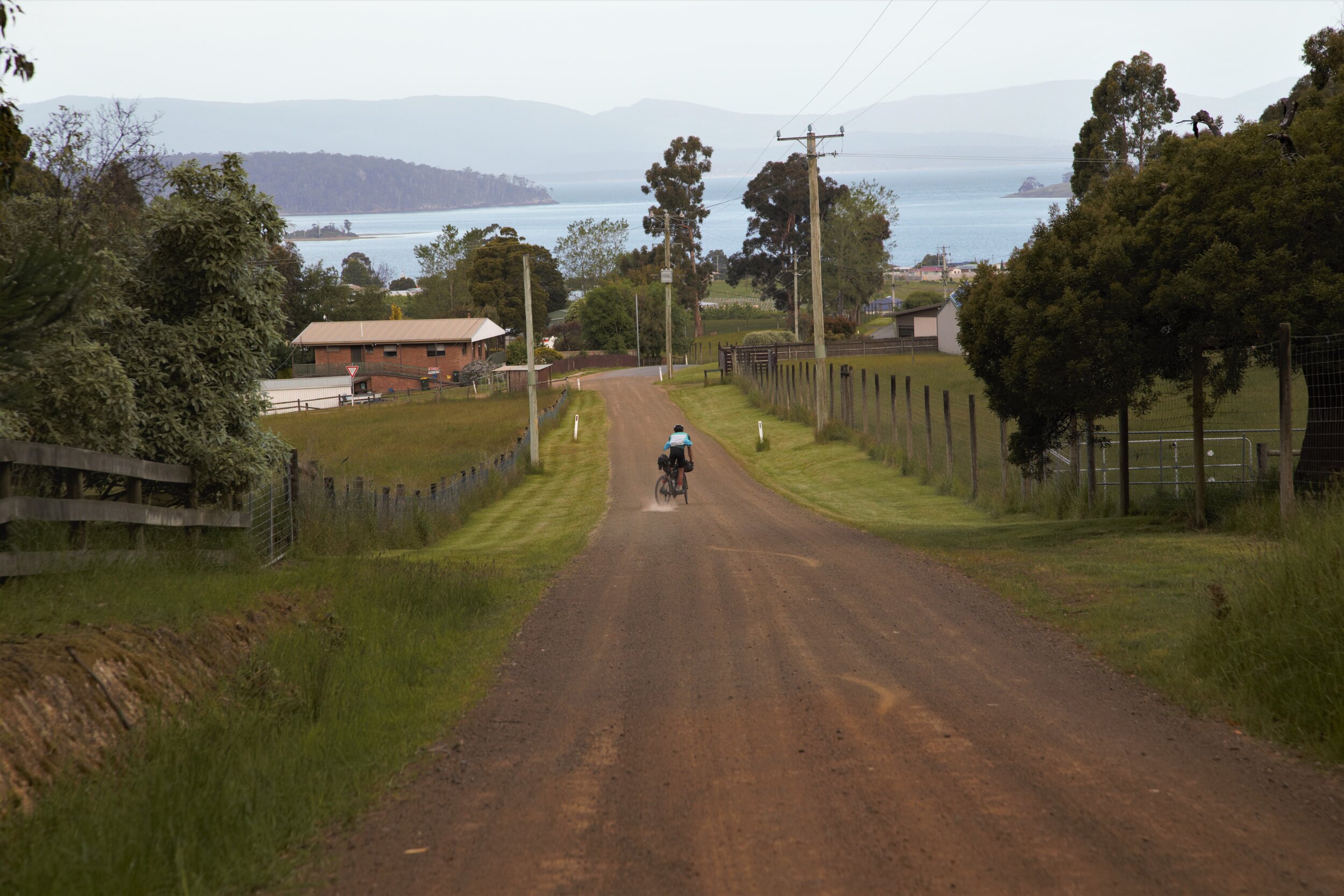
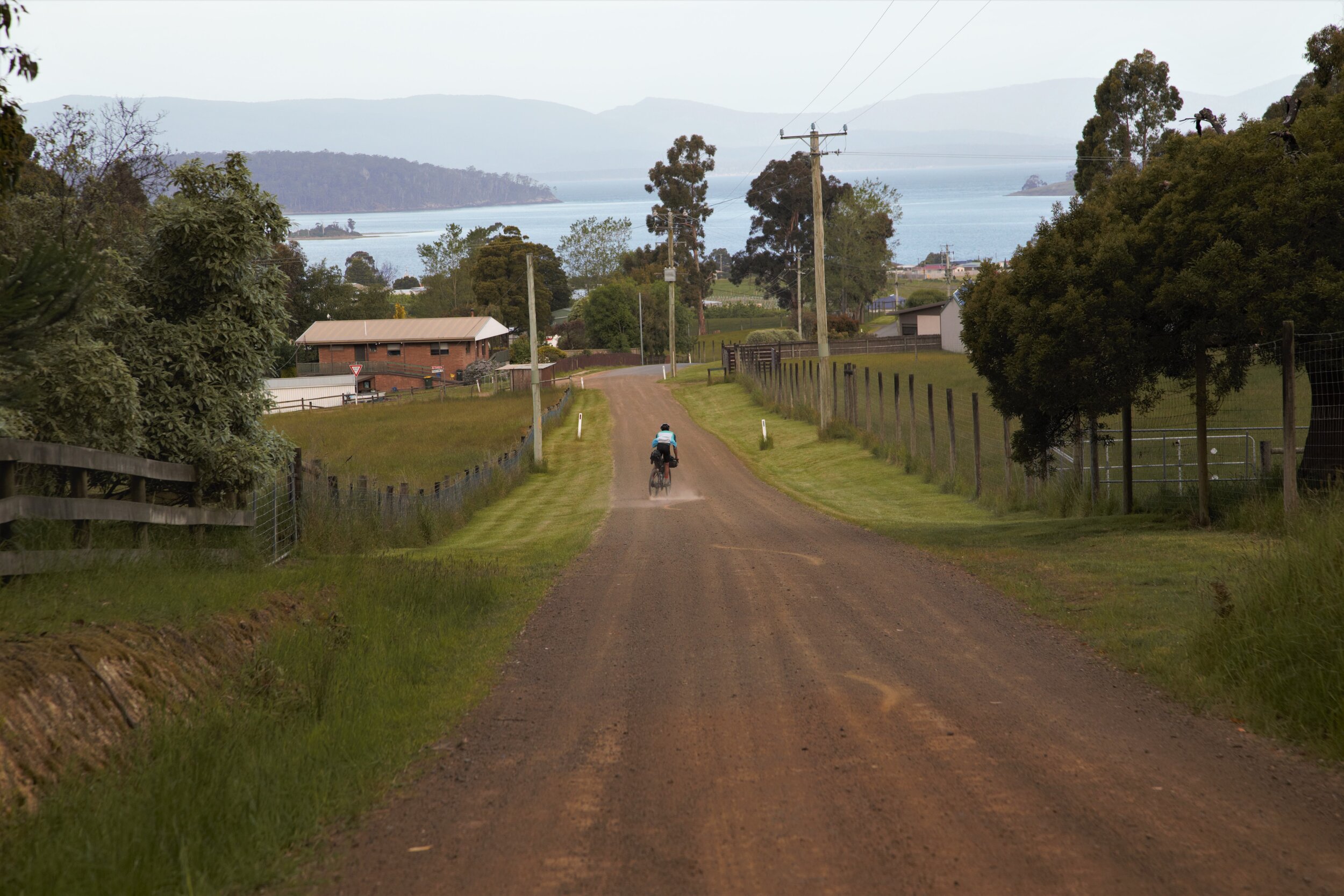
Feeling like we were on the way out with farmland now blanketing the landscape, we enjoyed scattering cows (ok yes I know I enjoyed it) and giving sheep a fright (that was more entertaining for the Australian part of this duo). Rolling over the hills in the next few kms we definitely had some incredibly ruggedly beautiful sights that to this day still sum up the trail in one photo for us.

Photo highlights of the trip

Photo highlights of the trip
By the time we rolled the final descent (yes there was still downward elevation to go!) to just 90m elevation it was 6pm - another huge day in the saddle. This time we scoped out our campsite but decided to eat dinner at the Lachlan Hotel first (we called ahead of course!) as rain was starting to splatter. They seemed very pleased to have non-local guests after I would imagine COVID probably kept them away for a long while. With homecooked meals on the board and specials like apple pie and sticky date pudding we soon realised this was about to be the best meal of the trip to top off an awesome day. The Lachlan Hotel also had rooms which would make for a cute little stay in Ouse if you decided not to camp!

Lachlan Hotel Legends
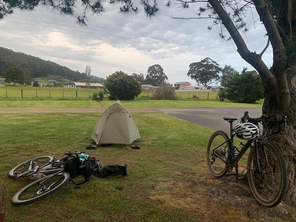
The Tasmanian Trail free campsite in Ouse is at the end of Ticknell Street in a large paddock. Roll through the gates at the end of the road and look for a shed and toilet a few hundred metres away slightly to the right. The little hut was a nice sheltered spot to dry our gear and prevent too much moisture getting on the tent overnight. We had a quick “tap shower” getting our kit off in the paddock and using baby wipes and the drizzle of cold water to get ourselves clean. The other great bonus here was the unlocked flushing toilet. All a duo of bikepackers could want at the end of a long day! Feeling chuffed we had made it through our last day we decided to sleep a little longer the next morning for it was our “easy day” after all. Little did we know….

Ouse campsite not without it’s marker

Tasmanian Trail free camp in Ouse
Day 3: Ouse to New Norfolk

Day 3: Ouse to New Norfolk
Distance: 76km Elevation: 1715m Moving Time: 5hr 45min Total Time: 9.5hrs
One word of advice - don’t leave your bananas out of a bag overnight. Possums like them too. We started a bit slow and creaky, dropping into the local IGA Xpress for some breakfast goodies, the spork always coming in handy for some fresh yoghurt! Today on the menu: pikelets topped with yoghurt and blueberries washed down with iced coffee (without bothering to find a hot one!).

Breakfast of Champions

Breakfast in a bus stop with a map of the Tassie trail in the background to keep us occupied!
Rolling out of town at about 9.30am we had a few ups and downs, photo ops then a down to this cool bridge - which of course we crossed *rebels*.

View back towards Ouse

Beware cattle stops with skinny tyres!
Rebel with a cause
We then made our way up and down again to Broad River crossing. Which was a tad swifter than our crossings two days before and I was glad I made sure I held the bike downstream as it did try to run away on me at times! The key to crossing a “light on bottom, heavy on top” full loaded gravel bike I realised is to not lift the bike but keep the wheels rolling and keep upright at all costs! The moment I lifted the bike or pulled the top of the bike toward me the wheels swept out and I was left awkwardly stuck up to my waist in the middle of the river! Made it to the other side - no real dramas just a bit of fun really!

Time to take the shoes off (for both of us this time!)

Swifter and deeper than you think!

Caution - try crossing first without gear!
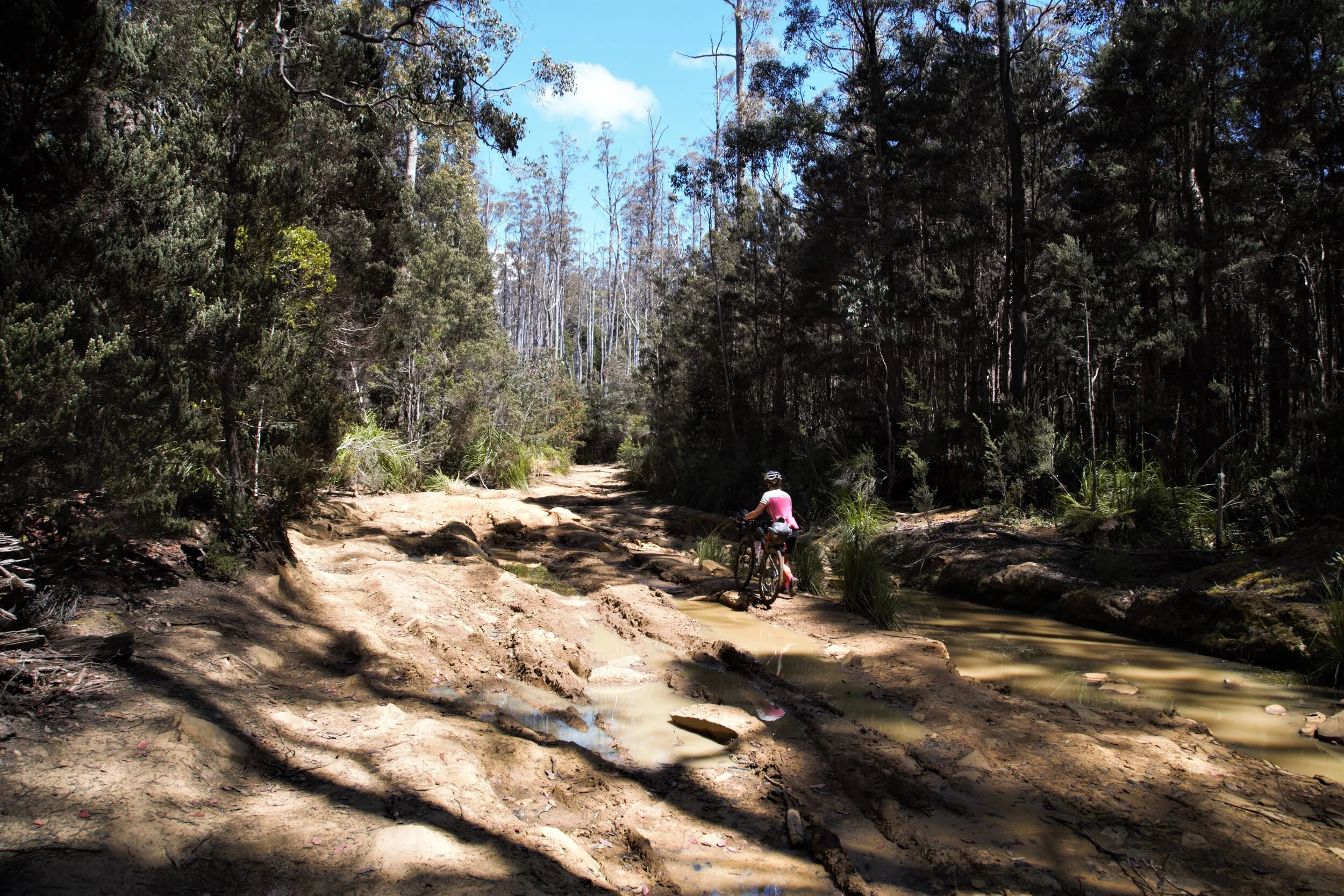
Making our way out of there going got a little slower as the fire trail got rougher. Bogs pictured below were not uncommon and although riding that on a mountain bike you could probably get by, with our smaller tyres, bags and uncertainty over what holes and rocks lay under the dirty water we took our time to walk around. There was a few steep gnarly ish down’s and up’s, then some cruisier fire road but eventually all things come to an end and we popped out onto Ellendale Road.

Boggy bits in this section - and it hadn’t been raining much at all that we were aware of!

And some steep bits

But of course also Tassie Trail beauty (the scenery I mean)
Hearing about Ellendale from Thor’s blog I was excited to visit. After all that hard work from the morning in the pretty warm sunshine I was ready for a lovely ice cream. Rolling along behind Cameron I was a little confused when he turned left on Ellendale road. But he was following the Garmin route which largely to this point was directing us just fine. It was a steep very fast roll down before a sharp quick right turn and didn’t allow much time for chat as we were rolling along some pretty nice gravel farmland roads with only beautifully long downhill sections ahead. The roads stretch out in the distance like a golden ribbon - enticing us for more!

It does look nice - but don’t take this road to Mt Bethune…you’ll read why soon

Heading to Mt Bethune

Cam’s Mates
We then got to a confusing turn off which you could go down to the river (which we eventually figured out was directions to the campsite only) or up the hill and through a gate - the trail. However it does pay to remember (more frequently than we did) that this trail is for horseriders and walkers as well as mountain bikers. We didn’t look at the guidebook which I am sure would have said to take the road through Ellendale on a bike. Instead, we started hike-a-biking Mt Bethune. See, it started not too crazy. Being able to ride through the long grass and zig zag up the hill a bit. Hike a biking wasn’t unheard of on this trail either. So we hiked and hiked and hiked. There was what looked like the top in front of us - which we arrived at only to find there was another hill behind it. My shoe broke from so much hike a biking. We (thought we) summited the second hill 45 mins later and decided we needed lunch, this was a little ridiculous!

How do I stop my Garmin beeping at me on Autopause because I am going too slow?

Not impressed

Thinking we got to the top
Markers are no different for Bike / Hike / Horse sections
We had a yummy vegemite and avo sandwich on the side of Mt Bethune with admittedly quite a nice view. Gathering up the bikes we pushed on - only to find 100m later that there was yet another ugly steep looking summit in the distance! I definitely uncharacteristically swore a few times at this moment! After a total of 2 hours (another 1 hr 15min after lunch) and 300 vertical metres hike a biking later we did actually reach the summit. It was a rather disappointing summit as when we saw where the trail took us down the other side we also realised we weren’t going to be riding out bikes anytime soon. Clambering over large piles of rocks the going got even slower again and my swearing did get worse until the point where I was actually grumpy whilst adventuring!

Spot for lunch
Finally we found where the trail snaked down a small valley (still not yet rideable!) ending up in steep paddocks filled with patches of large prickles. Jumping on our bikes for the first time in about 3 hrs we dodged prickles, found the gates along barbed wire fences and finally got back onto the road! Ahhh what a feeling. I was hammered. It was still a few kms to get back to Ellendale road and when we got there it was a little disheartening to know we had taken about a 4 hour detour over Mt Bethune, compared with rolling through Ellendale town along the road about 20km! After a quick debrief - I was buggered and we were low on supplies - we decided to skip one of the sections of the trail which immediately turned off Ellendale road to head over another hill. Instead we rode into the next available “town” called Bushy Park to the closest shop at Bushy Park Roadhouse to get water, fuel, mood food (in this case the long awaited ice cream!). We learnt here you can definitely NOT drink the tap water so again had to buy water as our only opportunity before heading back into the bush.
Riding out of Bushy Park it was getting pretty late around 4/4.30pm or so, the sun was pretty warm but my spirits had improved after the ice cream and actually being able to ride the bike had never felt so good. After a small road section we once again crossed Lyell Hwy onto Black Hills Road and soon greeted by some friendly baby Alpacas and a horse at the start of the climb. The name says it all from 26m elevation near Bushy Park up to 518m at the top of Black Hills Range. The gravel was perfect, the road steep and challenging and in the beautiful afternoon light, life was again good.

Hey guys hows life?

Friendly gal

Views from Black Hills Road

Life is good
Riding along the top of Black Hills Range
Riding along the top was pleasant through the trees and we were looking forward to getting to our destination that night for some proper campground facilities and larger town supermarket food options. Chatting away we started to approach the descent - probably the best of the trip! The Tassie trail sure knows how to keep on giving! A good 25 minutes later we reach the river and town centre of New Norfolk rolling in at 6.30pm - so much for our shorter day! Beautiful river setting for the town - and for our campsite right on the riverside! We stopped off at Coles on the way (so we didn’t need to venture out again!) and stocked up with pasta, veges and some choccy for dessert of course!
At the New Norfolk Caravan Park for just $30 total we had a sweet camp spot, bagged a picnic table and a BBQ and had access to free hot showers…winning! Another tip which I frustrated myself with a couple times is to also always ask “So what’s the deal with the Laundry here?” when checking in. Campgrounds are large places and walking to the laundry to find you need coins you don’t have, then going back to the tent to get your cash to exchange, then calling the office because it’s after hours and finally getting your coins all takes about 30mins of precious “I could be eating my dinner already” time for a hungry bikepacker. Doing your washing is usually also the factor that keeps you from going to bed earlier as it usually takes a couple hours to wash and dry. An even better idea is to handwash clothes and just use the dryer. Although unfortunately our wringing out skills aren’t as good as a commercial washing machine so the one cycle in the dryer isn’t enough to fully dry them!
“Always ask on the way into a campground - “So, what’s the deal with the Laundry and Showers here?” Things like what coins you need and how many for the shower, washer and dryer is super useful information up front!”

Yummy tucker - mastering the art of single pot cooking
After sorting petty laundry woes we cooked and enjoyed our picnic table until the washing was done and the mozzies drove us into the tent for another night. No picture of our camp spot this night, I was too busy sorting out the washing!
Day 4: New Norfolk to Dover (the end)

Day 4: New Norfolk to Dover
Distance: 100km Elevation: 2362m Moving Time: 7.5 hr Total Time: 11hrs
We did rise early this day as we knew we had another long day ahead with our most elevation in one day but it was our last day also! It was a chilly start in the valley of New Norfolk and we rolled out to get brekkie from Mood Food - a very well stocked servo just down the road. We ate breakfast in the carpark and loaded up the bags with lunch and morning tea + ride snacks as we didn’t plan to pass though a town for the first 70km - therefore most of the day.
We rode steady alongside the Lachlan river for a while before turning up into the hills. Boy was it a hill! Rideable for the most part of the 800m elevation gained - starting with quite a nice gravel section, turning to rough gravel, turning then to super rough and rocky 4WD territory. Although we did take great satisfaction toodling up the rough deep 4WD sections on our skinny little bikes whilst the noisy dirt bikes and big 4WD truck drivers watched us with a confused look. Then proceeding to take their time navigating the rough terrain with their big vehicles. We were quietly pretty happy with ourselves in front of these guys until just up the road when I realised I had a slow leak that wasn’t sealing due to a side wall graze and we had to stop. We popped a tube in and carried on but it did feel like the end of good progress for a while and not to mention slightly deflating our egos.
We mostly had to walk across the top as it was super rocky. Fine to ride with a mountain bike, without bags or with plenty of spare tubes but the fact we didn’t have any of those luxuries it wasn’t worth another flat (and our last tube in the middle of nowhere!) to ride rough.
Rock gardens everywhere

Bogs again
4WD heaven
A couple km’s later we got hungry again, had stopped climbing and decided it was time for a yummy roll from Mood Food on the side of the track near White Timber Mountain. Nutrition wise - always a good idea to eat a bigger meal at the top of the hill, you aren’t going to be working hard again too soon after lunch and mentally it is nice to know you are about to jump back on the bike for a fun downhill! We were able to ride again by this point and so we got back on and started to head down. Again, I keep repeating myself but it is true! An amazing downhill, long long long and fun but we had to stop several times just to give the hands a rest from the brakes! We crossed a cool ford on the way down, chatted to some kiwis filling up their water tank and topped up our bottles with fresh mountain water yay!

Time for lunch

Finally able to ride again

Massive downhill stretch
Several km’s down the road we popped out under some powerlines which is usually a bit of a firebreak and you can usually ride or run in the clear underneath them. However this one was MEGA steep! It was a little terrifying setting off at the top to give it a go, gravel bike, no dropper post, bags stopping you from getting back from the saddle and little tyres in sometimes deep gravel. Off we went skiding and sliding so slowly, we could have walked faster for the first section but gathering a bit of speed and confidence as we made our way down to the bottom. Once again having an adrenaline break, stetching the hands before carrying on down the cool forestry roads into Judbury.

The top of the powerlines downhill section - impressively steep!

The mega steep bit right at the top - photos never do it justice!
By this stage it was warm again and familiar thoughts of ice creams popped into my head. Alas we knew there would not be shops and Judbury confirmed this - I forget how small town, small towns can be! Crossing the mighty Huon River (by bridge of course) we got a very short section of sealed road before heading up onto gravel Bermuda Road. This was another one of my favourite Tassie Trail climbs - Cameron rode up ahead of me for a little while this time, leaving me in the serenity of my own sweat, appreciation for the views, pain and dreams of ice cream. Climbing the ridge alongside Dickson’s creek was pretty in the afternoon sunshine and we soon met back up as the road came out of the trees and snaked around a foresty section. It was then I bugged him enough to crack open the emergency can of coke he had been carrying for two days (yes that included over Bethune!). It wasn’t even an emergency, I just felt like some caffeine. But thank goodness we did because heading around another corner we wer fronted with one of the steepest (rideable) climbs of the trail. Using the snaking technique riding in S shapes up the hill, we got there in the end! Not long later we had a lovely local lady call out to us as we were riding past offering a cup of tea and a biscuit. It was tempting but we had to press on - many km’s left and the day once again slipping away from us!

Don’t forget the Vegemite we are in Australia after all!
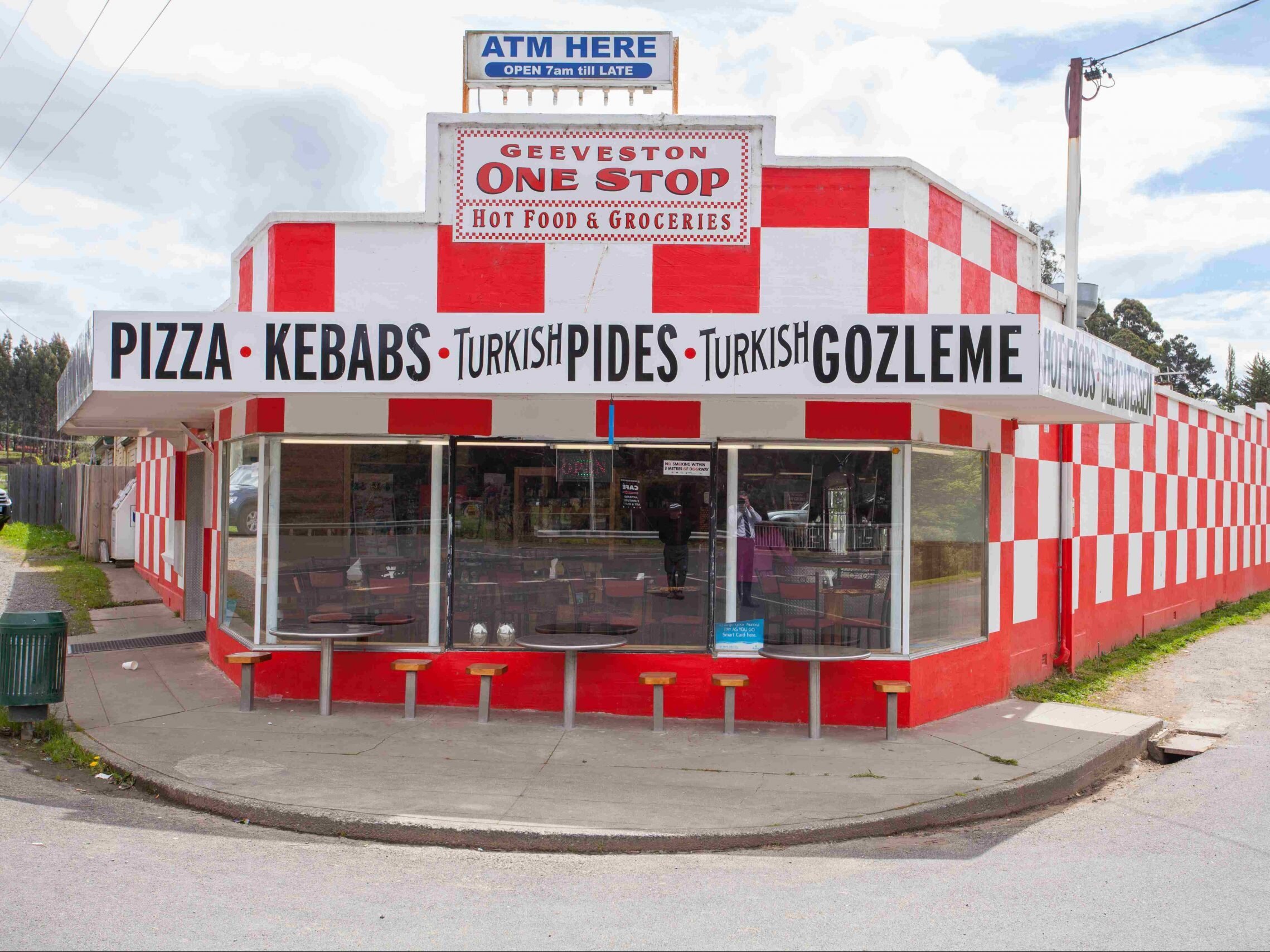
We headed down into Geeveston arriving about 5pm - still with 30km to go. We stopped for a refuel of water and food at the famous Geeveston One Stop shop which conveniently is at the intersection on the trail. After a quick tour of this cute looking little town (definitely didn’t do it justice!) we rode on again to tackle yet another couple climbs before home.
Out on to forestry roads we came across the first two people we have seen on the whole trail! Two fellow gravel bikers from Sydney! Taking their time more than we did and following the trail in its classic format - a little more conventional and probably wiser so. Well after that excitement we headed up some mild hills in comparison to the rest of our trip, chatting away and remembering how much fun we had the last few days. Reaching the top of the first section we realised there was an old detour signed that was no longer required. Cameron had read about a bushfire that had passed through a section of the trail and a boggy, hilly, less than ideal detour that had been put in place in the meantime. Folks - you no longer need to take the detour. Follow my Strava and you’ll be right. The Tassie trail markers were super confusing through here so be careful if that is all you are using.
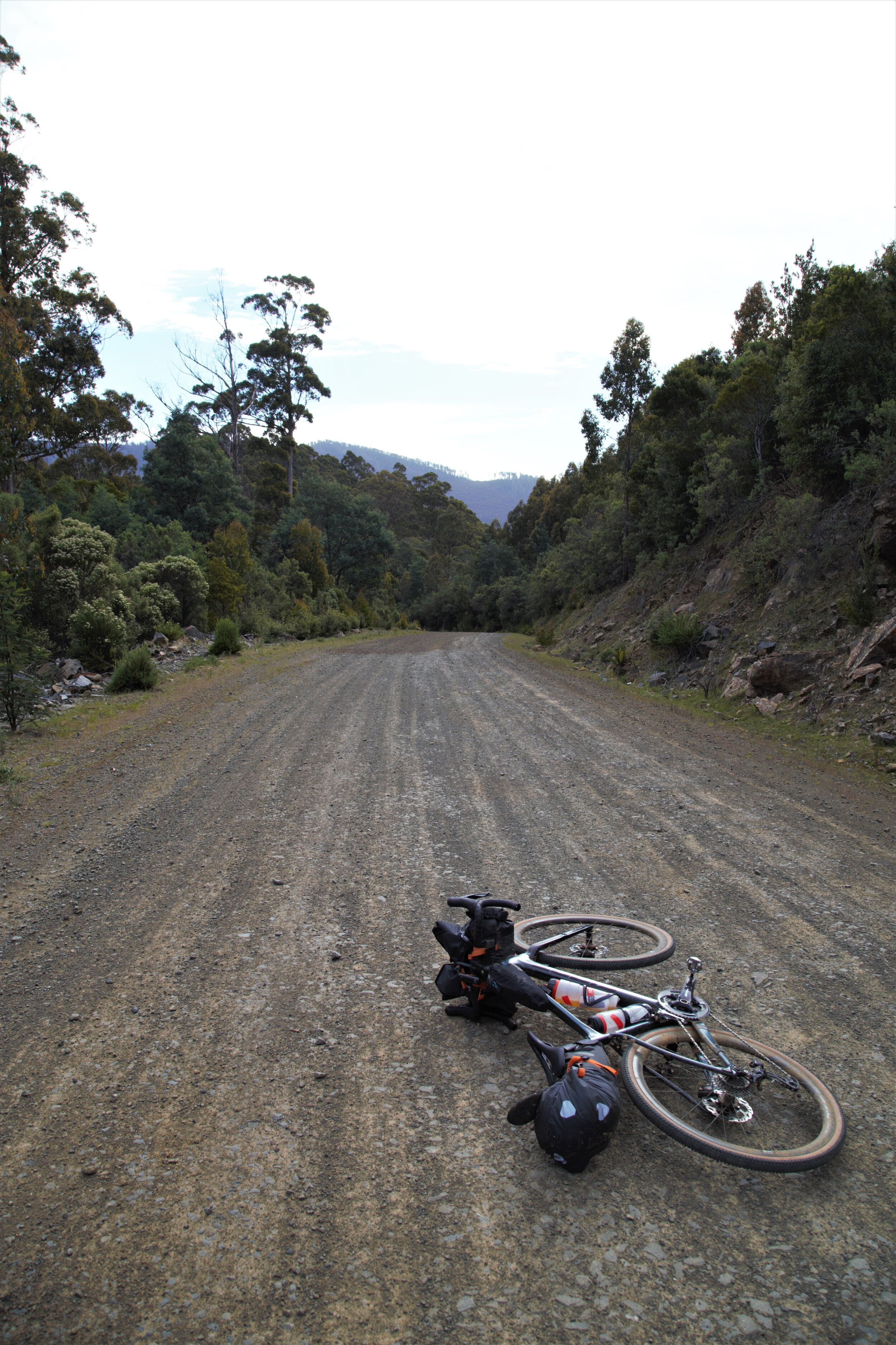
Wide open forestry roads - nice way to finish

Heading towards the final descent
Snaking our way through the forestry and some unremarkable but yet still beautiful gravel riding we finally reached the final downhill. Zipping up our vests and popping the gloves on as it was after 6pm by this stage, we rolled on down. What a great final descent! Fire roads were laced with beautiful ferns and a nice gradient to save our sore hands from braking too much. Then all of a sudden we broke out of the ferns onto a straight downhill section with uninterrupted views of the trail ahead to the ocean in front. I am pretty sure there was a few celebratory calls at this point, we did pose for a few pics of course and Cameron did some fun skids before rolling into Dover.


Boys will be boys
Just to pause the finish line elation I have there for a second - the end is quite confusing. We rolled in and it is quite obvious you turn left to the centre of town. But there must have been a turn halfway down the road where the magnificent view was with a trail marker on it. We missed it completely but didn’t care - we found the Start/End Tasmanian Trail marker on Chapel Lane. After a few pics we decided we needed to eat and realised the time! It was almost 7pm and knowing these small Tassie towns we were super lucky the Dover Top Shop was still open across the road (until 7pm!). Quickly getting some food, we sat in a nice park in the centre of town and toasted ginger beers for our finish.

We rolled into to the campsite for the night weary, sore but elated to have completed this part of our Tassie Adventure. We stayed at the Dover Beachside Tourist Park for just $25 total including UNLIMITED hot showers, a little shed with a kettle, toaster and some tables and chairs and laundry facilities. The other awesome addition to this friendly campground was the cockatoo at reception greeting you as you walked in “hello, hello, hello” then mimicking your conversation. I can’t remember his name but he was a delight. We checked in at the office about 7.45pm - thankfully as the office closed at 8pm! But we also learnt (after my laundry questions of course) that the laundry closed at 8pm also - eek! Doing a very fast unpack, change and handwash we managed to just get the clothes in the dryer in time. A late set up of the tent, charging of the electronics and finally our bikepacking admin was complete and we could rest for what was the longest day.

Who’s a pretty boy then?
Dover Beachside Tourist Park

Aftermath
The following days we went on to ride to Kettering, then catch the ferry to Bruny for two days of cruisy riding and food touring around the island but that story is for another day. Totalling: 787km and 11,882m elevation by the end of the week.
Trip stats: Across 5 days of Tassie trail from Railton to Dover + riding from Launceston to start
Distance: 543km Elevation: 8238m Moving Time: 28 hrs Total Time: 39hrs
Also for you bike gear nerds…
Cameron’s bike + gear weighed: 22.1kg My bike + gear weighed: 17.6kg
The Tassie trail was an epic adventure, not for the faint hearted nor ill-prepared but certainly for the intrepid and those seeking a peaceful, challenging adventure that exists in the beautifully rugged true Tasmanian wilderness.
I see it being enjoyed by such a range of people! You could;
Ride it fast as we did in 3-5 days on a gravel or MTB with big days, lots of elevation and km’s
Ride it slow and take 7-10 days, enjoy the afternoons, long lunches and stay at more cool small towns along the way
Ride it fully self supported as we did with tent, cooker, gas and sleeping gear (therefore heavier but also cheaper in free campsites)
Flashpack without all the camping gear and just take minimal emergency gear, stay in cute little bnb, hotel and campground cabins and choose either the fast long days or the slow and enjoyable days
Of course you could hike / run it too (or horse ride but I know nothing about that mode of transport!)
Then for the crazy people out there (you know who you are and I admire you) you could just give it a go non-stop with a bivvy and lots of food (due to limited fill up stops that would have to be well timed along the way)
However you choose, just do it. When we booked our first trip to Tassie I was hesitant - will it be as good as all the other stuff people rave about? It’s just a bunch of farm roads isn’t it? Should we take MTB’s for Derby etc instead? Should we do a trip around East Coast on the bikes? I was wrong to question the idea, it absolutely turned out to be the highlight of the trip.
Feel free to check out my Strava for the GPX files. Just be aware the following sections:
We started in Launceston and met the trail in Railton
Look out for the trail marker leading down to Quamby Brook - we missed it and went around the road through Golden Valley instead, which was fine
We skipped a section and went via road to Poatina and up Poatina road climb - highly recommend avoiding that hike a bike
Go through Ellendale instead of over Mt Bethune - and enjoy an ice cream for my sake please!
After Ellendale but before Bushy Park there was a section of the trail we missed - follow trail markers or another person’s route for this section
Definitely follow our route from Geeveston to Dover - avoid using the trail markers they point in confusing directions and are potentially still encouraging the old detour due to the bushfire
Thanks for reading, Happy riding!
